
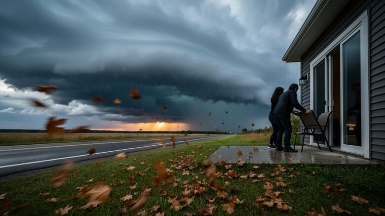
An orange watch for a severe thunderstorm means conditions are currently favorable for dangerous weather to develop, bringing potentially damaging wind gusts, large hail, and torrential rain to your area. Issued by Environment and Climate Change Canada, this high-impact, high-confidence alert tells you to prepare now, not later. The distinction matters: a watch gives you advance warning to secure outdoor items, charge devices, and identify shelter before conditions deteriorate, while a warning means the severe weather is already occurring or imminent.
The wind speeds during these storms can rival the operational thresholds of commercial wind turbines. Where modern turbines cut out around 90 km/h to prevent damage, severe thunderstorm gusts routinely exceed 90 to 100 km/h, generating tremendous destructive force in seconds rather than sustained power. Understanding this comparison highlights why these alerts demand immediate attention from anyone outdoors, particularly those working near renewable energy installations or in exposed environments.
This guide clarifies what an orange watch means, what actions you should take right now, how it differs from other alert levels, and where to find real-time updates. Whether you’re at home, managing a wind farm, or planning outdoor activities, knowing how to respond to this specific warning level can protect lives, property, and equipment.
What an Orange Watch Severe Thunderstorm Alert Is
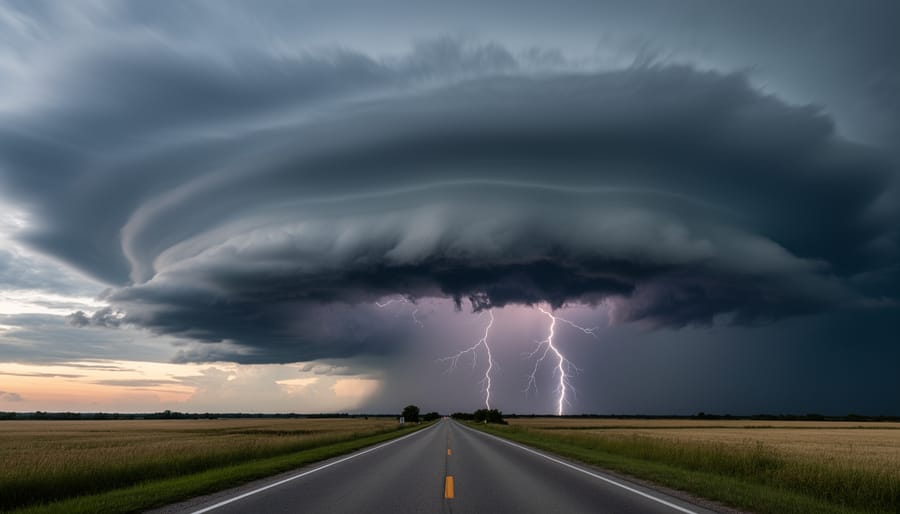
An Orange Watch for severe thunderstorms represents one of the most serious alert levels issued by Environment and Climate Change Canada. This classification signals that atmospheric conditions are favorable for severe thunderstorm development in the affected area. Unlike lower-level alerts, an orange watch carries both a high impact level and high forecast confidence, meaning meteorologists have strong certainty that dangerous weather conditions are likely to occur and could significantly affect public safety and property.
The orange designation reflects the substantial threat these storms pose. When Environment Canada issues this alert, they’ve identified specific atmospheric ingredients coming together that can spawn powerful thunderstorms. These conditions include unstable air masses, sufficient moisture, and triggering mechanisms like cold fronts or low-pressure systems that can rapidly intensify convective activity.
The potential hazards associated with orange watch severe thunderstorms are considerable. Strong wind gusts can exceed 90 kilometers per hour, powerful enough to break branches, damage roofs, and knock out power lines. Large hail, sometimes reaching the size of golf balls or larger, can shatter windows, dent vehicles, and destroy crops in minutes. Heavy rain accompanying these storms can produce flash flooding, particularly in urban areas with poor drainage or low-lying regions where water accumulates quickly.
What distinguishes an orange watch from routine thunderstorm activity is the combination of intensity and confidence. Meteorologists don’t issue this level lightly. The high forecast confidence means multiple weather models and observational data point toward the same outcome, giving the public valuable lead time to prepare before conditions deteriorate.
Who Should Pay Attention: Understanding Alert Eligibility
When Environment and Climate Change Canada issues an orange watch for severe thunderstorms, the alert applies to everyone within the specified geographic zone mentioned in the bulletin. The coverage area typically encompasses entire regions, counties, or municipalities where atmospheric conditions favor severe thunderstorm development, and every person in that zone should be aware of the heightened risk.
However, certain groups face elevated exposure and must take immediate preparedness action. The following populations should treat an orange watch as a prompt for active preparation:
- Outdoor workers including construction crews, landscapers, utility maintenance staff, and transportation workers
- Renewable energy facility operators managing wind turbines and solar installations vulnerable to high winds and hail
- Agricultural workers, particularly during harvest operations or livestock management
- People living in mobile homes, temporary structures, or buildings with older roofs
- Event organizers conducting outdoor activities, festivals, or sports events
- Boaters, campers, and others engaged in outdoor recreation
If you fall into any of these categories, shift from passive monitoring to active preparation. Secure equipment, postpone risky outdoor work, and identify immediate shelter options. Vulnerable infrastructure like wind turbines may need operational adjustments or shutdown protocols as conditions deteriorate.
For others within the alert zone, the orange watch means staying informed rather than taking immediate shelter. Monitor updates regularly, know where you’ll go if conditions worsen, and be ready to act quickly if the watch escalates to a warning. The high forecast confidence and high impact level that define orange watches mean the threat is credible, even if severe weather hasn’t yet developed.
How to Respond to an Orange Watch Alert
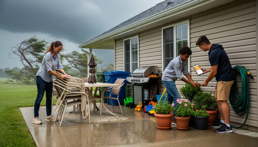
When Environment and Climate Change Canada issues an orange watch for severe thunderstorms, your priority shifts from routine awareness to active preparation. The high impact level and high forecast confidence mean conditions could deteriorate quickly, so start your response immediately rather than waiting to see what develops.
Check the official alert details first. Note the geographic area covered, the valid time period, and the specific hazards mentioned, strong wind gusts, large hail, or heavy rain. Set up notifications on weather apps or tune to local news for updates every 30 to 60 minutes, because watches can escalate to warnings with little advance notice.
Secure anything outdoors that wind could turn into a projectile. Bring in patio furniture, planters, children’s toys, and garbage bins. If you have a trampoline or canopy, anchor it properly or disassemble it. Tie down tarps and close umbrellas. Park vehicles in garages if possible, or away from trees and power lines. For those operating renewable energy facilities or working outdoors, this is the time to implement your severe weather protocols and consider pausing exposed activities.
Review your emergency plan with household members or coworkers. Identify the safest shelter location, an interior room on the lowest floor, away from windows, preferably with reinforced walls. Basements are ideal, but if you don’t have one, a bathroom, closet, or hallway works. Gather emergency supplies in this location: flashlight, battery-powered radio, first aid kit, water, and charged mobile devices.
Prepare to act quickly if the watch upgrades to a warning. A warning means severe weather is occurring or imminent, and you’ll need to move to shelter immediately rather than continue preparations. The transition from favorable conditions to dangerous weather can happen in minutes, so complete your preparation steps while the watch is still in effect.
Wind Speeds and Energy Implications
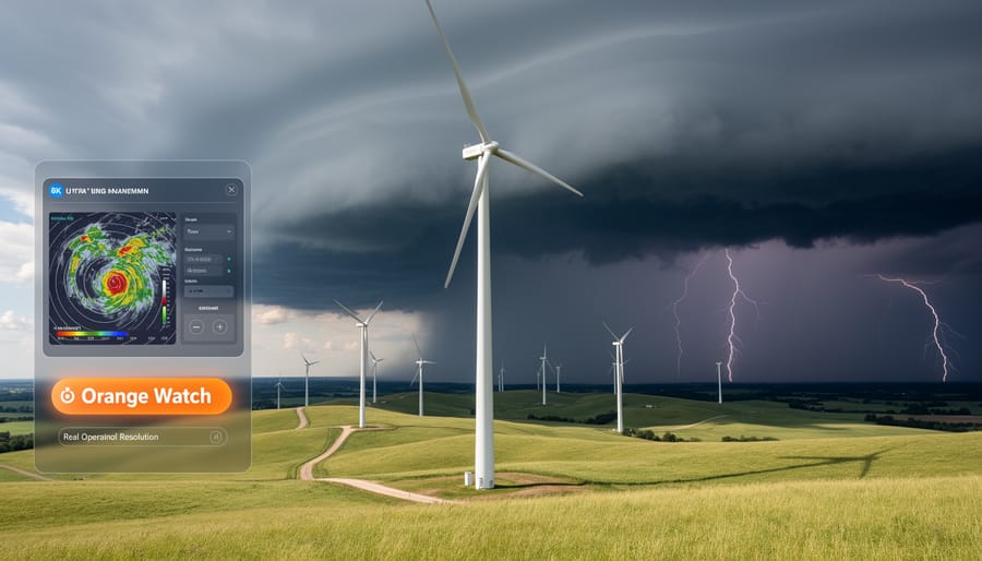
Severe thunderstorms under an orange watch can produce wind gusts between 90 and 120 km/h, occasionally exceeding these speeds in the most intense cells. These velocities place storm winds well above the typical operational range of modern wind turbines explained as designed for steady winds between 10 and 90 km/h. Most turbines reach peak power generation at around 50-55 km/h, then automatically begin feathering their blades and reducing rotor speed as winds approach their cut-out threshold.
| Wind Condition | Speed Range (km/h) | Turbine Response |
|---|---|---|
| Severe Thunderstorm Gusts | 90-120+ | Shutdown required |
| Optimal Power Generation | 45-60 | Peak output |
| Typical Cut-Out Threshold | 90-100 | Automatic shutdown |
| Survival Wind Speed | 180-250 | Design limit (parked) |
When orange watch alerts are issued, renewable energy operators implement pre-storm protocols. Wind turbine technicians monitor forecasts closely and initiate controlled shutdowns before gusts reach dangerous levels, positioning blades to minimize stress on the tower and nacelle. This proactive approach protects equipment that can cost millions to repair while ensuring worker safety, as technicians evacuate turbines well before conditions deteriorate.
The dual nature of wind creates a paradox for renewable energy: the same atmospheric dynamics that generate power also threaten infrastructure. A wind farm might operate at full capacity in the morning, then shut down completely within hours as a severe thunderstorm approaches. Understanding the impacts of strong winds helps operators balance energy production with equipment protection, ensuring turbines survive extreme weather to generate power for years ahead.
Understanding Watch vs. Warning Levels
The fundamental difference between a watch and a warning can mean the difference between having time to prepare and needing to take immediate shelter. A watch, like the orange watch severe thunderstorm alert, means conditions are favourable for severe weather to develop. Think of it as nature’s advance notice, giving you time to secure loose items, review your emergency plan, and keep an eye on the sky. A warning, by contrast, means severe weather is occurring or imminent in your area, requiring immediate action to move to safety.
Environment and Climate Change Canada uses impact level and forecast confidence ratings to help the public understand the seriousness of each alert. The orange watch classification carries both a high impact level and high forecast confidence, signaling that meteorologists are quite certain severe conditions will develop and that those conditions pose significant risks. When a watch escalates to a warning, you’ll receive updated alerts through emergency broadcast systems, weather apps, and official channels.
Severe thunderstorm watches sometimes appear alongside tornado watches when atmospheric conditions support both types of severe weather. A tornado watch indicates the potential for severe thunderstorms capable of producing tornadoes, representing an even more dangerous scenario. If you’re under multiple watches simultaneously, treat the situation with heightened vigilance. Watches typically last several hours and cover broad geographic areas, while warnings are more localized and shorter in duration, reflecting the actual movement of a specific storm cell through your community.
Your Rights and Responsibilities During Severe Weather
When Environment and Climate Change Canada issues an orange watch for severe thunderstorms, you have both protections and obligations. Understanding what you can expect and what’s required of you helps ensure everyone stays safe.
What Weather Authorities Owe You
Environment and Climate Change Canada must provide timely, accurate alerts when conditions favor severe thunderstorm development. You’re entitled to clear information about the impact level (high for orange watches), forecast confidence, and potential hazards like strong wind gusts, large hail, and heavy rain. Modern tools that track storms with radar make it easier to see exactly where threatening weather is developing, giving you actionable data beyond text alerts.
Your Responsibility to Act
Receiving an alert isn’t enough. You must actively monitor conditions as they evolve, especially since orange watches indicate high confidence that severe weather will develop. When weather radar helps you see a storm approaching your area, you’re responsible for taking protective action, securing property, seeking shelter, and warning others who may be unaware.
Employer Obligations
Canadian occupational health and safety laws require employers to protect workers during severe weather. If you work outdoors or in vulnerable structures, your employer must have severe weather protocols, provide shelter access, and potentially halt dangerous operations when an orange watch escalates to a warning.
Property and Insurance Considerations
While you have the right to protect your property, insurance coverage for storm damage typically requires reasonable preventive measures. Document conditions before storms hit, and keep records of any protective steps you take when alerts are issued.
Where to Get Official Updates and Assistance
Environment and Climate Change Canada operates the primary alert system through WeatherCAN, their official mobile app available for iOS and Android devices that delivers push notifications for severe weather warnings in your area. The agency also maintains comprehensive weather information at, where you can view current alerts, radar imagery, and detailed forecasts.
Official monitoring sources include:
– Environment and Climate Change Canada’s WeatherCAN app and website for federal alerts
– Alert Ready system delivering emergency broadcasts to TV, radio, and compatible wireless devices
– Provincial emergency management offices for region-specific guidance and evacuation orders
– Local municipal emergency information lines listed on your community’s official website
– VHF weather radio frequencies (162.400 to 162.550 MHz) for continuous NOAA broadcasts in border areas
Your provincial or territorial emergency management organization coordinates post-storm assistance, including damage assessment teams and disaster relief programs. Many municipalities operate 311 service lines for non-emergency storm damage reporting. If you witness severe weather phenomena like funnel clouds, damaging winds, or large hail, report your observations to Environment Canada through their official channels, these citizen reports help meteorologists verify warnings and improve future forecasts for your community.
How to Apply or Complete the Process
Unlike most weather preparedness topics, orange watch severe thunderstorm alerts don’t require you to submit applications, register with authorities, or complete formal compliance processes. These alerts are public warnings issued by Environment and Climate Change Canada to keep everyone informed about dangerous weather conditions.
Your “process” is straightforward: receive the alert, assess your situation, and take appropriate protective action. You don’t need to confirm receipt, register your location, or notify officials that you’ve seen the warning. The system works one-way, from meteorologists to the public.
However, if you operate critical infrastructure like wind energy facilities, agricultural operations, or outdoor venues, you should have internal protocols for responding to orange watch alerts. These aren’t government requirements but prudent operational procedures: documenting when alerts are received, recording what actions your team took, and logging weather conditions observed on-site.
After severe weather passes, you may need to report significant damage to property insurers or document workplace incidents for occupational health and safety records. If you observe particularly dangerous conditions like funnel clouds or damaging winds, Environment Canada welcomes public reports through their official channels, though this remains voluntary rather than mandatory.
The key distinction is simple: orange watches inform you so you can prepare; they don’t obligate you to complete paperwork or follow bureaucratic steps.
Where to Get Official Help
Environment and Climate Change Canada is the official authority for all severe weather alerts in Canada, including orange watch severe thunderstorm notifications. You can access current alerts and detailed weather information through their website at, where alerts are updated in real-time as conditions develop or change.
For immediate weather information, call the Weatheradio Canada network, which broadcasts continuous weather updates and warnings on dedicated VHF frequencies across the country. Check Environment Canada’s website to find the frequency for your area.
Your local emergency management office provides community-specific guidance during severe weather events and can direct you to shelter locations if needed. Contact information is typically available through your municipal government website or by dialing 311 where available.
If you experience property damage or require emergency assistance during a severe thunderstorm, dial 911 for immediate life-threatening situations. For post-storm assistance, contact your provincial emergency management agency, which coordinates disaster response and recovery resources.
Report severe weather observations directly to Environment Canada through their weather reporting page or social media channels. Your reports help meteorologists track storm development and improve warning accuracy for your community and neighbouring areas.
Frequently Asked Questions
What does an orange watch for severe thunderstorm mean?
An orange watch indicates conditions are favourable for the development of severe thunderstorms, with both high impact level and high forecast confidence. This means the atmospheric conditions support storm formation, though severe weather hasn’t developed yet.
What wind speeds can severe thunderstorms under an orange watch produce?
Severe thunderstorms covered by orange watch alerts are capable of producing strong wind gusts, though specific thresholds vary by region. These gusts can be powerful enough to cause property damage, down trees, and create hazardous conditions for outdoor activities and infrastructure including wind energy facilities.
How long does an orange watch typically last?
Watch durations depend on how long atmospheric conditions remain favourable for severe thunderstorm development, typically ranging from several hours to most of a day. Watches remain in effect until conditions change, storms develop and trigger warnings, or the threat diminishes.
What should I do if I’m caught outdoors when an orange watch is issued?
Move indoors to a substantial building as soon as possible and avoid open areas, tall isolated objects, and bodies of water. If you can’t reach shelter immediately, monitor weather conditions closely through official channels and be ready to take protective action if the watch escalates to a warning or conditions deteriorate rapidly.
Understanding these basics helps you respond appropriately when alerts arrive. The distinction between watches and warnings matters most when you’re making decisions about outdoor activities or travel plans. A watch gives you time to prepare and position yourself safely, while a warning means protective action should be immediate.
Remember that severe thunderstorms pose multiple hazards beyond wind, including large hail and heavy rain that can cause flash flooding. The orange classification reflects both the potential severity of impacts and meteorologists’ confidence in the forecast, making it a reliable signal to take preparedness steps seriously rather than waiting to see what develops.
An orange watch severe thunderstorm alert isn’t a cause for panic, but it demands your attention and action. These high-confidence forecasts give you precious time to prepare before dangerous conditions arrive. Secure outdoor items, identify safe shelter, review your emergency plan, and keep monitoring official updates from Environment and Climate Change Canada.
Understanding severe weather connects directly to our broader relationship with natural forces. The same wind energy we harness for renewable power becomes hazardous under the right atmospheric conditions. By respecting these warnings and preparing appropriately, you protect yourself, your property, and your community while developing the environmental awareness that makes us better stewards of our planet.
Share weather safety information with neighbors, coworkers, and family members who might not have seen the alert. Your preparation today builds resilience for tomorrow’s weather challenges.