
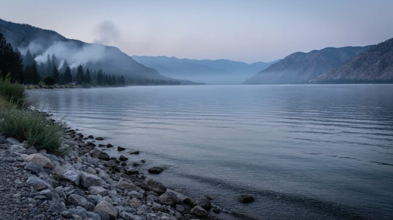
Osoyoos air quality currently reads moderate on the Air Quality Index, a status residents and visitors should monitor closely when planning outdoor activities in the South Okanagan. This rating means air quality is acceptable for most people, though unusually sensitive individuals may want to limit prolonged outdoor exertion.
The reading you see today reflects the unique geography of this valley town. Osoyoos sits in a basin where wind patterns play a crucial role in dispersing or concentrating airborne particles. Right now, light winds rotating at low speeds around 1 km/h mean pollutants can linger rather than clear quickly. During wildfire season, which remains British Columbia’s primary air quality concern, even gentle shifts in wind direction determine whether smoke drifts into the valley or bypasses it entirely.
Understanding what these numbers mean helps you make informed decisions about your day. British Columbia uses the Air Quality Health Index (AQHI), a scale from 1 to 10+ that accounts for three key pollutants: ground-level ozone, particulate matter, and nitrogen dioxide. Real-time readings update throughout the day on an interactive provincial map covering more than 80 percent of the population across 14 communities, including the South Okanagan region.
Wildfire smoke from forests and grasslands continues to be the dominant source of air pollution affecting Canadians, making wind direction and speed critical factors in local air quality. When you check Osoyoos conditions, you’re not just seeing a snapshot, you’re getting insight into how natural ventilation patterns protect or expose this pocket of the Okanagan to broader environmental conditions.
Understanding Osoyoos Air Quality Right Now

Right now, Osoyoos air quality falls within the Good to Moderate range on the Air Quality Health Index, meaning most residents can go about their daily activities without concern. Current conditions show relatively low levels of air pollutants, though it’s always smart to check the latest readings before planning extended outdoor time, especially if you have respiratory sensitivities.
The Air Quality Health Index uses a scale from 1 to 10+ to communicate health risk, with categories color-coded for easy interpretation. A reading of 1-3 (Low Risk, shown in blue) means excellent conditions for everyone. When the index climbs to 4-6 (Moderate Risk, yellow), most people can still enjoy outdoor activities normally, but those with heart or lung conditions might want to reduce intense exercise during peak pollution hours. Readings of 7-10 (High Risk, orange) signal that even healthy adults should consider scaling back strenuous outdoor work, while anything above 10 (Very High Risk, red) calls for significant activity adjustments across the population.
What does this mean for your day? Under Good conditions, you’re clear for hiking, cycling, or working in the yard without restrictions. Moderate readings suggest keeping an eye on how you feel during prolonged exertion, particularly if you’re older, pregnant, or managing chronic health conditions. Children can play outside normally at both levels, though parents of kids with asthma should watch for symptoms like coughing or shortness of breath that signal it’s time to head indoors.
How Wind Patterns Shape Air Quality in the South Okanagan
Current Wind Conditions and Air Movement
Wind patterns play a critical role in determining whether pollutants accumulate over Osoyoos or disperse into the broader atmosphere. Right now, local winds are rotating between 33 and 85 degrees at approximately 1 km/h, a light easterly flow that moves air slowly through the valley. At this gentle pace, the wind lacks the force needed to rapidly flush out particulate matter, pollen, or other airborne pollutants that settle into the basin.
When wind speeds drop below 5 km/h, the air becomes nearly stagnant. Pollutants released from vehicles, wood smoke, or drifting wildfire haze linger close to the ground rather than dispersing vertically or horizontally. This creates pockets of higher concentration, especially in low-lying areas where cool air settles overnight. Residents may notice hazy conditions persisting through morning hours even when regional air quality reads as moderate or good.
Conversely, winds above 10-15 km/h act as a natural ventilation system. Stronger gusts push polluted air out of the valley corridor and draw in cleaner air from surrounding regions. The direction matters too: easterly winds from the interior can carry cleaner air, while westerly flows might pull in smoke from active fire zones during summer months.
Valley Geography and Air Circulation
Osoyoos sits in a narrow north-south valley where the mountains create a natural corridor that channels air movement. This funnel effect means pollutants don’t disperse evenly, they concentrate in the valley bottom during calm conditions and flow along predictable paths when winds pick up.
Temperature inversions pose the biggest air quality challenge here. Cold air settles into the valley overnight and gets trapped beneath a layer of warmer air above. This lid prevents vertical mixing, so any smoke or pollutants released at ground level stay locked in place rather than dispersing upward. You’ll notice this most on winter mornings when the air feels heavy and still.
The valley’s orientation also creates distinct seasonal wind patterns. Summer afternoons often bring thermal winds as the valley floor heats up, pulling cooler air from the north. These circulation patterns can either flush out pollutants or, when combined with wildfire smoke drifting from surrounding forests, concentrate particulates in the valley for days.
Local topography turns Osoyoos into a series of microclimates. The hillsides experience different air movement than the lakeside areas, which is why air quality readings can vary significantly within just a few kilometers.
What’s Actually in the Air: Common Pollutants in the Region
The air above Osoyoos carries a mix of pollutants that vary with the seasons, weather patterns, and regional activities. Understanding what’s floating in the atmosphere helps you make informed decisions about outdoor time and health precautions.
Particulate matter dominates air quality concerns in the South Okanagan. PM2.5 refers to fine particles 2.5 micrometers or smaller, about 30 times thinner than a human hair, that penetrate deep into lungs and even enter the bloodstream. PM10 particles are slightly larger but still small enough to be inhaled. Both types come from combustion sources, dust from unpaved roads, and agricultural operations. During calm wind conditions, these particles linger in the valley instead of dispersing.
Wildfire smoke represents the most significant seasonal threat to Osoyoos air quality. Smoke from wildfires in forests and grasslands serves as a major source of air pollution for people in Canada, particularly during summer and early fall. When fires burn across British Columbia or drift from neighboring regions, they release massive quantities of PM2.5 along with carbon monoxide and volatile organic compounds. The valley geography can trap this smoke for days, turning moderate conditions into hazardous readings.
Ground-level ozone forms differently than particle pollution. It’s not emitted directly but creates when sunlight triggers chemical reactions between nitrogen oxides and volatile organic compounds. Hot, sunny days with stagnant air produce the highest ozone levels, typically peaking in afternoon hours. Vehicle exhaust and industrial emissions provide the raw ingredients for ozone formation.
Weather conditions determine how these pollutants behave. Strong winds disperse particles and dilute concentrations rapidly. Temperature inversions, common in valley locations during winter mornings, trap pollutants near the ground like a lid on a pot. Light winds rotating at low speeds allow pollutants to accumulate rather than clear out, which explains why identical emission sources can produce vastly different air quality readings on different days.
Reading the Air Quality Health Index for British Columbia
Checking real-time air quality conditions in Osoyoos starts with British Columbia’s interactive air quality map system, which provides current Air Quality Health Index (AQHI) values and forecast maximums for communities across the province. The South Okanagan is among 14 regions covered by this monitoring network, serving more than 80 percent of British Columbia’s population with accessible air quality data.
The AQHI uses a scale from 1 to 10+ to communicate health risk. Low readings (1-3) indicate minimal concern for most people, while high values (7-10) signal that even healthy individuals should reduce outdoor exertion. The system goes beyond simply measuring pollutant concentrations by calculating health risk based on how air contaminants actually affect the body. Understanding AQHI and wind patterns together gives you a complete picture of why air quality changes throughout the day.
| AQHI Range | Health Risk | General Population | At-Risk Groups |
|---|---|---|---|
| 1-3 | Low | Enjoy usual outdoor activities | Enjoy usual outdoor activities |
| 4-6 | Moderate | No need to modify activities | Consider reducing intense outdoor exercise if symptoms occur |
| 7-10 | High | Reduce outdoor exertion | Avoid strenuous outdoor activities |
| 10+ | Very High | Avoid strenuous outdoor activities | Avoid all outdoor physical exertion |
At-risk groups include children, seniors, pregnant women, and anyone with respiratory or cardiovascular conditions. These individuals feel air quality impacts at lower AQHI values than the general population. The interactive map updates hourly and includes three-day forecasts, so you can plan outdoor activities around predicted air quality changes rather than reacting after conditions decline.
Wildfire Smoke: The Biggest Air Quality Challenge
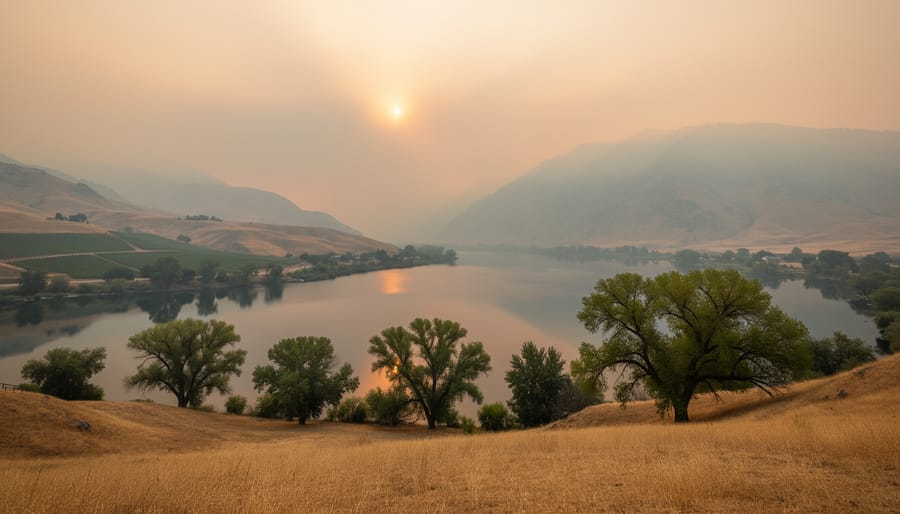
Wildfire smoke represents the most significant and unpredictable threat to Osoyoos air quality, capable of transforming a clear summer day into a health hazard within hours. Smoke from wildfires in forests and grasslands can be a major source of air pollution for people in Canada, and the South Okanagan’s geographic position makes it especially vulnerable to both local fires and smoke drifting from distant blazes across British Columbia, Washington State, and even further afield.
The region’s peak wildfire season typically runs from July through September, when hot, dry conditions create ideal fire weather. During active fire seasons, smoke can linger in the valley for days or even weeks, with particulate concentrations spiking to hazardous levels. The same valley topography that creates Osoyoos’s famous wine-growing climate also traps smoke during calm wind periods, particularly when temperature inversions lock polluted air near the ground.
Wildfire smoke air pollution contains fine particulate matter (PM2.5) small enough to penetrate deep into lungs and enter the bloodstream, making it more dangerous than many other air pollutants. Even healthy adults can experience burning eyes, scratchy throat, and reduced lung function during heavy smoke days.
Preparation starts with monitoring forecasts. Check air quality maps daily during fire season, particularly the AQHI forecast maximums available through British Columbia’s interactive monitoring system. Stock up on N95 or KN95 masks before smoke arrives, not during an event when supplies run short. Create a clean-air room in your home by sealing windows and running portable air filters. When the AQHI climbs above 6, cancel strenuous outdoor activities and keep vulnerable family members indoors with filtered air.
The Connection Between Energy Choices and Air Quality
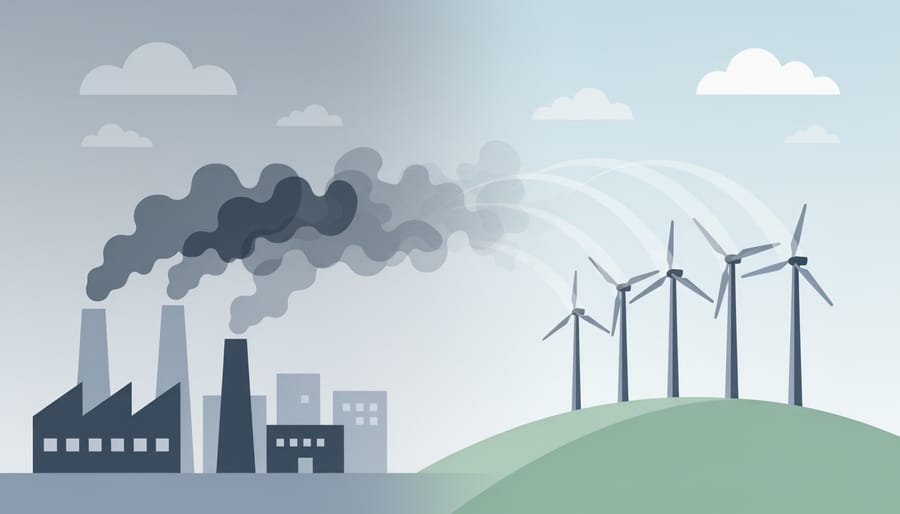
Every time you flip a light switch or adjust your thermostat, you’re making a choice that ripples far beyond your home, straight into the air you breathe. The energy sources powering our communities directly determine the quality of air flowing through the South Okanagan valley. Traditional fossil fuel power plants release particulate matter, sulfur dioxide, and nitrogen oxides, the same pollutants that trigger AQHI data access warnings during poor air quality days.
Wind and solar installations generate electricity without combustion, meaning zero direct emissions of PM2.5, PM10, or ground-level ozone precursors. When a region shifts 10 percent of its electricity generation from coal to wind, studies show measurable drops in hospital admissions for respiratory conditions within a single season. British Columbia’s expanding renewable energy infrastructure has contributed to some of the cleanest air quality readings in Canada, even as population and energy demand have grown.
The Okanagan benefits doubly from this transition. Cleaner electricity means fewer baseline pollutants competing with seasonal wildfire smoke, the region’s primary air quality challenge. During wildfire season, communities already dealing with renewable energy grids start from a lower pollution baseline, making moderate smoke events less likely to push readings into hazardous territory. Cities that have invested in solar farms and wind projects report 15 to 30 percent lower annual average PM2.5 concentrations compared to similar communities relying on fossil fuel generation.
Your energy choices compound. Choosing renewable electricity providers, supporting community solar projects, and advocating for wind farm development all reduce the pollutant load entering Osoyoos air. Cleaner energy infrastructure means fewer days when you need to check air quality before stepping outside.
What You Can Do When Air Quality Declines
When air quality declines in Osoyoos, taking immediate action protects your health and helps reduce additional emissions. Start by checking the AQHI reading for the South Okanagan, if it climbs above 4, consider moving planned outdoor workouts indoors or rescheduling strenuous activities for early morning when pollutant levels typically drop. Children, older adults, and anyone with respiratory conditions should limit time outside during moderate to high readings.
Indoors, close windows and doors to keep smoke and particulates out. Run your HVAC system on recirculation mode if available, or use a portable HEPA air purifier in main living spaces. Avoid activities that worsen indoor air quality, like burning candles, frying foods, or vacuuming, which stirs up settled particles.
You can also reduce local emissions on poor air quality days. Combine errands to limit vehicle trips, or walk and bike for short distances when the AQHI permits. Delay using gas-powered lawn equipment and postpone wood burning. These small adjustments decrease pollutant load during vulnerable periods.
Understanding wildfire smoke effects helps you respond appropriately, smoke particles penetrate deep into lungs, so even healthy individuals should reduce exposure. If you’re planning to visit Osoyoos, check the forecast maximum AQHI before booking outdoor activities. Conservation choices, from adjusting your thermostat to choosing energy-efficient appliances, reduce the power demand that contributes to regional emissions year-round.
Frequently Asked Questions About Osoyoos Air Quality
Is it safe to exercise outdoors when the air quality is Moderate?
Most healthy adults can exercise outdoors during Moderate air quality conditions without concern. However, if you have asthma, heart disease, or respiratory conditions, consider reducing the intensity of outdoor workouts or moving activities indoors when the AQHI rises above 3.
When should I close my windows during poor air quality?
Close windows when you notice smoke haze, smell smoke, or when the AQHI reaches 7 or higher. If you have respiratory sensitivities, closing windows at AQHI levels of 4-6 is a smart precaution, especially during wildfire season.
How long does poor air quality typically last in Osoyoos?
Poor air quality episodes vary widely depending on their cause. Wildfire smoke can persist for days or weeks during active fire seasons, while pollution from other sources may clear within hours as wind patterns shift and disperse pollutants across the valley.
Where can I check current air quality conditions for Osoyoos?
British Columbia provides real-time air quality readings through an interactive map that covers the South Okanagan region, including the Air Quality Health Index and forecast maximums. This system serves more than 80 percent of the population across 14 communities in the province.
Understanding when air quality poses a genuine health concern helps you make informed decisions about daily activities. The AQHI scale simplifies interpretation: readings of 1-3 indicate low risk for everyone, 4-6 suggest moderate risk for sensitive individuals, and 7-10 signal high risk requiring action.
Seasonal patterns matter in the South Okanagan. Summer and early fall bring the highest wildfire risk, when smoke from forests and grasslands becomes a major source of air pollution. Spring typically offers the cleanest air as cooler temperatures and rainfall reduce both fire activity and ground-level pollutants. Winter can bring temperature inversions that trap emissions close to the valley floor, though pollution levels generally remain lower than during fire season.
Children, older adults, and anyone with heart or lung conditions should pay closer attention to air quality forecasts. For these groups, even Moderate conditions warrant adjustments to outdoor plans, particularly for strenuous activities lasting more than an hour.
Staying informed about Osoyoos air quality isn’t just about checking a number, it’s about understanding the conditions that shape your daily life in the South Okanagan. With real-time AQHI data available through BC’s interactive mapping system, you have the tools to make smart decisions about outdoor activities, protect your health during wildfire season, and respond appropriately when conditions shift.
The valley’s unique geography and wind patterns mean air quality can change quickly. Regular monitoring helps you stay ahead of these fluctuations rather than reacting after symptoms appear. Whether you’re planning a morning hike, deciding when to close windows, or determining safe conditions for children’s outdoor play, current data empowers better choices.
Beyond personal actions, supporting renewable energy development directly improves the air we all breathe. Wind and solar power replace emission-heavy energy sources that contribute to regional pollution. Every shift toward clean energy reduces particulate matter at its source.
Check the Air Quality Health Index before heading outdoors, especially during summer months when wildfire smoke poses the greatest risk. Share forecasts with neighbors. Advocate for conservation policies that protect the Okanagan’s air quality. Small, consistent actions compound into meaningful change for your community’s environmental health.